Map showing Rothera research station, Alexander Island and Palmer Land. Note George VI Ice Shelf.
These photographs are from our November to December 2012 season to Alexander Island on the Antarctic Peninsula. We undertook 5 weeks of fieldwork, where Mike Hambrey, Bethan Davies and Ian Hey (BAS Field Assistant) investigated both modern and ancient ice-shelf moraines.
We spent four weeks at Ablation Point Massif, an Antarctic Specially Protected Area. In order to avoid damaging sensitive landforms and the delicate ecology, we used no vehicles, walking across the land and frozen lake. This meant landing a twin otter aeroplane on George VI Ice Shelf and walking from there to our basecamp.
You can explore our field area with the Google Map below. If you look carefully, you’ll be able to see the frozen Ablation Lake and the pressure ridges as the ice shelf presses against Alexander Island.
The map below shows our field area, our basecamp and the depot on the ice-shelf.
Simple map of Ablation Point Massif, showing our field sites and location of our depot on the ice shelf.
The photographs below show the field area, camp life and working conditions. You can read more about it on my blog.
We were deployed in early November by a single Twin Otter aircraft, which landed on George VI Ice Shelf. We man-hauled all our equipment to a basecamp among the moraines.
Leaving Rothera behind
Icebergs caught in sea ice, viewed from the Twin Otter in early Summer, before the sea ice melts.
Bethan flies the twin otter
Ablation Lake and Ablation Valley from the air
Ablation Lake and Ablation Valley from the air
Ablation Lake, with pressure ridges from George VI Ice Shelf
Ablation Valley; The Mound with tongues of glacier ice either side.
Flying over our field area; Moutonnée Valley
Moutonnée Valley. Note the ice-dammed lake and George VI Ice Shelf behind.
Ablation Point, with ice-shelf pressure ridges and ice-shelf moraines.
Ice shelf moraines, Ablation Point
Landing the twin otter on Georve VI Ice Shelf, about 4 km from our intended basecamp
The route is unknown and must be carefully tested for crevasses
Manhauling all our kit towards basecamp, across the flat and floating ice shelf
Manhauling two sledges
Our first night at basecamp. We arrived and set up camp at around midnight.
It took three days to manhaul all our kit. This is us returning to the depot.
Camplife
We were camped in one three-person tent and we had a poo tent for comfort! We slept, cooked at ate in the tent, using primus stoves and tilly lamps. As it was very cold (about -20°C in early November), we had to cut and melt snow for drinking water. On days when the weather was poor, we worked in the tent, analysing our date and measuring clast shape.
Ian Hey walks across a frozen pond on the ice-shelf moraines
At -20°C, you have to melt snow for drinking water
Making tea involves cutting snow to pan-sized blocks.
A plane visits, buzzing basecamp
Inside the tent, with the stove on for a cup of tea.
The tide crack at the margin of the lake
Dramatic clouds around basecamp
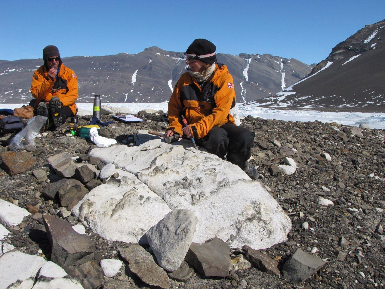
Mike Hambrey measureing pebbles to learn about glacial processes
Ian Hey recording pebble measurements during a lie-up day.
Clouds threatening our basecmap
Fieldwork
Fieldwork comprised mapping and logging the ice-shelf moraines, and their older equivalents at higher elevations. We took cosmogenic nuclide samples of erratic granite boulders from Palmer Land to investigate the age of these older moraines.
The ice-shelf pressure ridges
Some pebbles show scratches (striations) from glacial action.
Frost action cracks the rocks
Blowing snow
The ice-cored moraines at the margins of the ice shelf
Ice-shelf moraines with Ablation Point in the distance
The ice-shelf moraines contain granite boulders from Palmer Land
Ablation Lake, with lake-ice pressure ridges
Trekking across the lake to map the other valleys
Lake ice pressure ridges
Lake ice pressure ridges
Lake ice pressure ridges
Ablation Valley with glacier moraines
Mike Hambrey mapping ice-shelf moraines
Glacier ice in the ice-shelf moraines
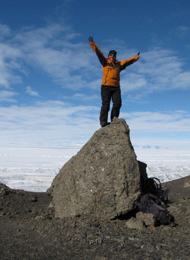
Bethan on top of a rock
We used sledges to drag our heavy rucksacks across Ablation Lake
Ablation Lake
Ian Hey at Ablation Lake
Ian Hey and Mike Hambrey crossing Ablation Lake
Lake ice pressure ridges
Ice shelf pressure ridges
Ice shelf pressure ridges
A cold-based glacier
Ablation Lake
The melt season starts
Pressure ridges through icicles
Mapping glacier moraines
Mapping glacier moraines
Mapping glacier moraines (from a large boulder!)
Mike Hambrey working
Large ice cliffs from George VI Ice Shelf push into Moutonnée Lake
Bethan Davies
Ian Hey
Bethan Davies taking a rock sample
A frozen waterfall from a cold-based glacier
Bethan Davies, well wrapped up
Uplift and Redeployment
We were uplifted at the end of November. It had gradually been getting warmer all month and the ice-shelf was starting to melt, which is why we were in the field so early.
Time to go; manhauling all our kit back to the depot
Time to go; manhauling all our kit back to the depot
Melting ponds makes life difficult
Striking camp in the snow
Manhauling out to the depot
Mike Hambrey arrives at the depot on George VI Ice Shelf
The plane is coming!
The plane finally arrives
Fossil Bluff
After four weeks at Ablation Point Massif, we moved on to Fossil Bluff, where the British Antarctic Survey have a refuelling depot. There is a skiway and a small stone cottage, “Bluebell Cottage”. We were there for four days, completing geomorphological mapping of the local area.