“Fluvioglacial” or “glaciofluvial” means erosion or deposition caused by flowing meltwater, from melting glaciers, ice sheets and ice caps. Glacial meltwater is usually very rich in sediment, which increases its erosive power.
Glaciofluvial landforms include sandar (also known as outwash plains; they are braided, sediment-rich streams that drain away downslope away from a glacier), kames and kettles, meltwater channels, and eskers.

Glaciofluvial systems are characterised by strong changes in flow magnitude and frequency. Flow magnitudes can fluctuate strongly on a daily basis, as melt increases and decreases over day and night. It also fluctuates seasonally, in the summer (ablation) and winter (accumulation) seasons.
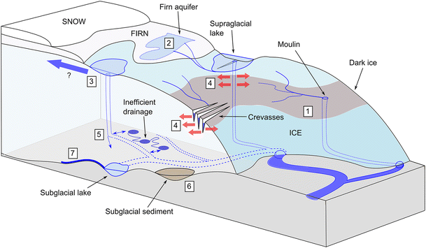
Glacier meltwater can flow supraglacially (on top of the glacier ice), englacially (within the glacier ice), subglacially (below the glacier ice) and proglacially (in front of, and away from, glacier ice). Surface meltwater can reach the bed by draining through the bases of crevasses and moulins.
These pages outline some of the key glaciofluvial landforms associated with the passage of glacial meltwater. For more information, see Glacier Hydrology.