Introduction to Proglacial Glaciofluvial Landforms | Outwash Plains | Kame and Kettle Topography | Kames | Kettles
What are proglacial glaciofluvial landforms?
Glaciofluvial landforms are created by glacial meltwater processes, occurring in supraglacial (on top of the glacier), englacial (within the glacier), subglacial (beneath the glacier) and proglacial (in front and beyond glacial margins) environments1.
Proglacial landforms are those found in front of, and beyond the glacier margins. Proglacial glaciofluvial processes produce a wide range of landforms, from the macroscale (outwash plains), mesoscale (braided river bars, kames) and microscale (ripples).
Types of proglacial glaciofluvial landforms
Outwash plains
Proglacial outwash plains, also known as ‘Sandur’ (after the Icelandic term for sand) 2 are braided, sediment-rich streams that drain downslope away from a glacier and are usually concave in long profile 1. Outwash plains are generally braided 3 and reach thicknesses of 100m 4.

Proglacial streams carrying large quantities of sediment emerge from the glacier via supraglacial portals and englacial conduits. Once outside of the ice margins, the velocity of the meltwater falls. This leads to the rapid deposition of material.
The largest sediment (usually gravel) is deposited first, forming an alluvial fan at the snout of the glacier, with the finer sediments (typically sand) carried further downstream away from the glacier.
When a number of these alluvial fans merge they form an outwash plain.
Outwash plains are dynamic features, with fluctuations across short term (daily) and long term (seasonally) scales. As a result, there are frequent changes to morphology. Additionally, large scale events, for example glacial lake outburst floods (GLOFs), can greatly change overall morphology 2.
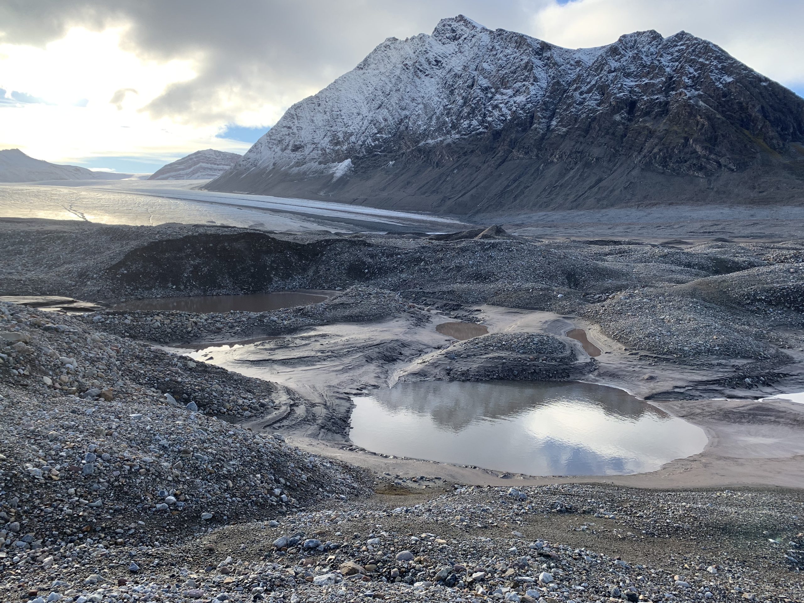
Kame and Kettle Topography
During the final stages of deglaciation, supraglacial and englacial systems rework large quantities of debris and ice, forming a number of glaciofluvial landforms on outwash plains 1. These include Kames and Kettle Holes.
Where kames and kettle holes are found together, they create mounds and ridges intervened with hollows known as Kame and Kettle topography (See Figure 3 as an illustration).
Kames

Kames, derived from the Scottish word ‘cam’ or ‘kaim’ (meaning steep sided mound) are isolated or clustered mounds or plateaus 6 made up of stratified sand and gravel and are the product of glaciofluvial deposition (as can be seen in Figure 2 4).
Where deposition occurs supraglacial, kame plateau may form, while marginal deposition between the glacier and sidewalls results in kame terraces (Figure 2). The best example of a kame terrace in the UK along the shores of Loch Etive in Scotland.
Kettle Holes
Kettle holes are hollows in the landscape and represent areas of subsidence caused by the melting of buried ice.
During deglaciation, sediment deposited by meltwater streams bury mounds of ice, insulating and preserving it. In time, these mounds of ice melt, leaving behind a depression in the surface (Figure 2, 3).
Depending on the rate of melt-out, kettle holes may infill, due to sediment position from meltwater streams routed into and around them (Figure 2). Otherwise, they are seasonally wet (known as kettle ponds), or permanently filled (kettle lakes) (Figure 3) 3.
Hello! Has the theory of kame formation changed in the last 50 years? I thought they were formed when glacial rivers deposited sand and gravel into lakes at the end of the melting glacier. Once the glacial lake lowered, the former underwater hills of sand and gravel appeared as kames.
More recently, it sounds like it is thought that the sand and gravel is deposited into lakes on the melting glacier, or that the sand and gravel fell threw holes in the ice of the melting glacier.
I’m confused! Which is correct or can kames be formed by all these processes?