I am now advertising four PhD studentships through the IAPETUS website.
IAPETUS will be awarding 13 studentships to start in October 2027. For more information on the application process, please see the IAPETUS website.
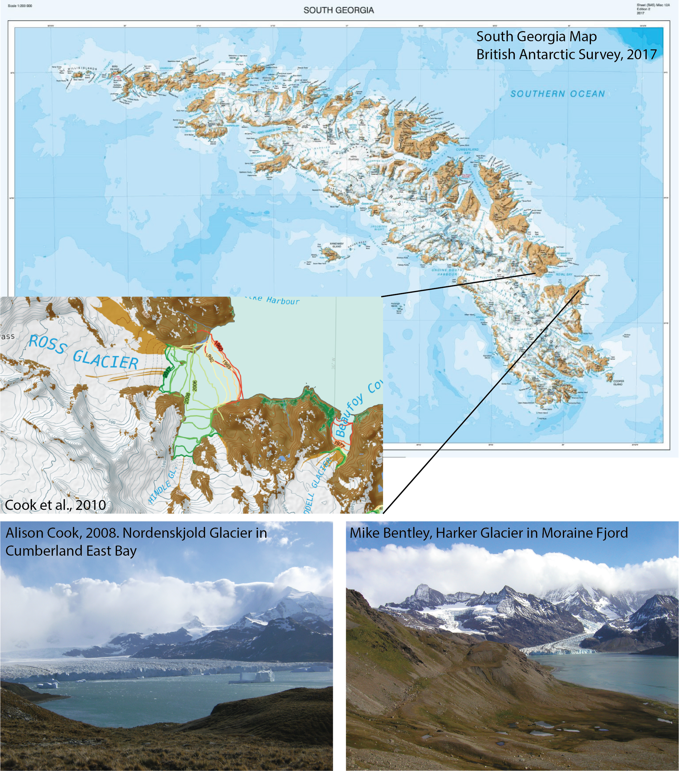
The glaciers of South Georgia from the 1950s to 2100 CE
The glaciers of the Subantarctic island of South Georgia are sentinels of climate change, being located directly in the path of the rapidly evolving Southern Hemisphere Westerlies. These Westerlies are a critical control on glacier behaviour both in Patagonia and the Antarctic Peninsula. South Georgia therefore offers a unique opportunity to investigate how changes in the Westerlies are reflected in glacier change.
Aim:
To quantify glacier behaviour in South Georgia since the 1950s and explore glacier responses to different climate conditions.
Research questions:
1. How have glaciers evolved from the 1950s to present?
2. How do surface structures (debris cover, crevasses, icefalls etc) influence glaciology and mass balance?
3. What are the mass balance sensitivities of glaciers?
4. How do changes in the Southern Hemisphere Westerlies influence glaciers, and how is this modulated through topographic effects?
5. How might the glaciers behave under future climatic conditions?
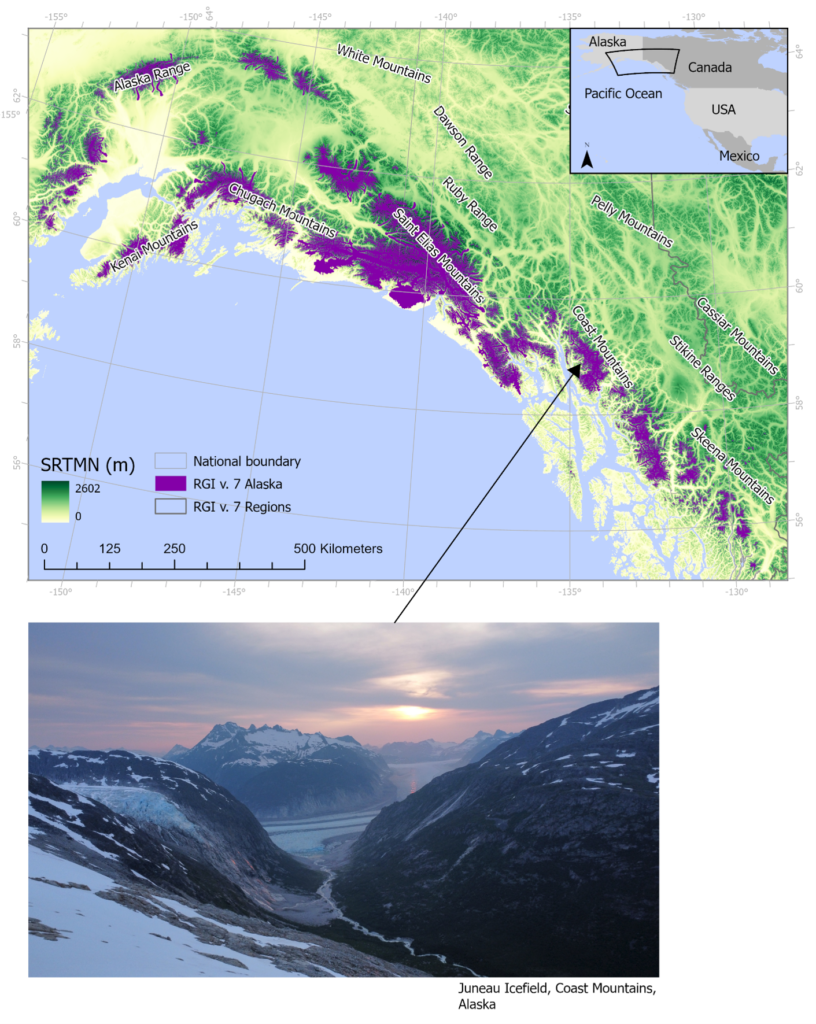
Late Glacial and Holocene glacier dynamics in southeast Alaska / British Columbia
The melt of Alaskan icefields is accelerating (Davies et al., 2024), and will continue to dominate glacier contributions to sea-level rise for decades to centuries (Edwards et al., 2021). However, the historical record of glacier fluctuations in Alaska is particularly sparse; projections of glacier change across Alaska are hampered by the short observational period and by the region comprising several climatic states. We therefore need better records of past ice behaviour, ideally across different climatic states, to calibrate numerical models and improve projections.
This project will generate new empirical datasets of glacier behaviour in southeast Alaska/ British Columbia across multiple climate states, including periods of rapid climate change analogous to the future. These datasets will be used in robust data-model comparisons to help improve forecasting of icefield behaviour.
Research questions:
1. Is there evidence of ice stabilisation during the Younger Dryas?
2. How did glaciers behave during Holocene neoglaciations?
3. Are glaciers now at their minimum extent or were they smaller during the Holocene Climatic Optimum?
4. What are the glacier-climate sensitivities and internal controls on icefield dynamics?
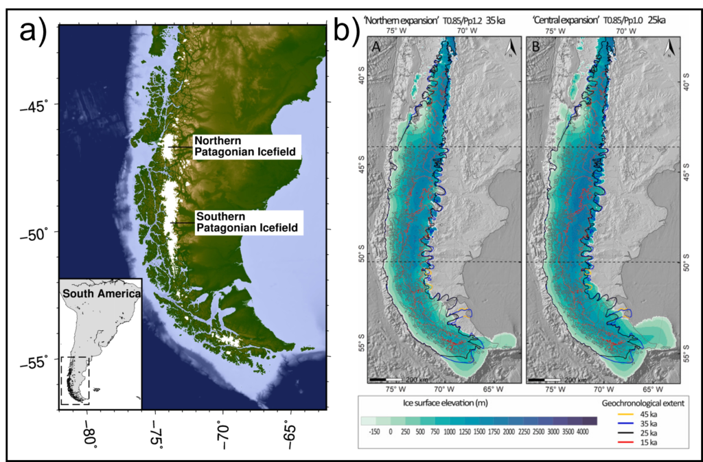
Understanding the Earth’s response to deglaciation of the Patagonian Ice Sheet
One of the largest uncertainties in quantifying present-day ice melt and its contribution to sea-level rise is understanding the process of glacial isostatic adjustment (GIA) – the delayed response of the Earth’s mantle to past and present changes in the weights of the ice sheet – that causes changes in the Earth’s shape, gravity field, and sea level. GIA is controlled by ice sheet history – i.e., the change in loading on the surface of the Earth – and the underlying mantle properties (e.g., Nield et al., 2014). GIA complicates the understanding of satellite gravity measurements that are used to track changes in global ice mass because of mantle mass flowing towards previously glaciated regions. Therefore, determining mantle structure and material properties will improve our estimates of ice melt and sea-level rise. To do this, we need to know the deglacial history of an ice sheet and have good observations of the associated glacial isostatic response (i.e., Earth deformation and sea-level change) through time. One location where this can be achieved is Patagonia.
This project aims to use loading histories from ice sheet models of the Patagonian Ice Sheet to constrain the associated evolving mantle properties and GIA signals of the region.
The Patagonian Ice Sheet reached its glacial maximum between 28,000 and 33,000 years ago (Davies et al., 2020) and subsequently almost completely deglaciated leaving only the northern and southern Patagonian Ice Fields. Its deglacial history has been reconstructed at a large scale (Davies et al., 2020) enabling the first dynamic simulations of the evolution of the Patagonian Ice Sheet (Lira et al., 2026). However, there remain some important questions about timing, extent and ice volume during deglaciation, particularly in southern Patagonia.
The 30m raised beach conundrum – reconstructing UK sea-level change and land motion over 200,000 years
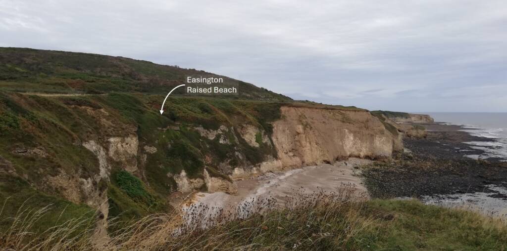
A couple of kilometres north of Easington, Durham (UK) lies a raised beach deposit in the exposed cliff ~33 m above modern sea level. Detailed research of the mixed sands, gravels and shells forming the unit indicate an inter-glacial age of 210,000 years BP and a high energy, temperate marine coastal depositional environment (Davies et al. 2009). While the raised beach’s age and interpretation are well constrained, many questions about it remain unresolved. These form the basis for this project, which aims to shed new light on the Quaternary sea-level change and uplift history of NE England.
Question 1: Is there other evidence of the raised beach along the Durham Coast? The observed exposure at Easington raised beach is 15 m wide and 5 m high but oblique photography of this portion of the Durham coastline shows other similar exposures that might be candidates to delineate its lateral extent as well as providing more information about the depositional environment and its age.
Question 2: When was the raised beach deposited during MIS-7? Davies et al. (2009) dated the beach giving ages ranging from 153 ± 17 to 250 ± 30 ka BP. However, greater accuracy of the timing of deposition during the inter-glacial is important to reconstruct its sea-level change and uplift history.
Question 3: Why is Easington raised beach at this elevation now, when other beaches of a similar age are much lower? Paleo-beach deposits of similar age in the south of England and Europe are ~25 m lower than the Easington raised beach (Cohen et al. 2022). Recent hypotheses suggest long-term isostatic uplift in the north of England due to a combination of upland erosion unloading the crust, and a warm layer in the asthenosphere lowering regional viscosity to enhance uplift (Davies et al. 2009). This local signal is thought to explain the elevation difference with southern sites.
An important contributor to uplift that is unaccounted for in this hypothesis is glacial isostatic adjustment (GIA). GIA is the ongoing deformational response of the Earth to past and present changes in the ice sheets. The regional history of GIA is deeply uncertain across the UK prior to 35,000 years ago (Scourse, 2024), and to our knowledge only one GIA reconstruction over multiple glacial cycles that incorporates regional sea-level change has been attempted (De Boer et al. 2014).
Thus, our understanding of the past and present GIA response to regional ice mass changes is both scientifically valuable and societally important because sea-level budgets and projections rely on its accurate reconstruction.